
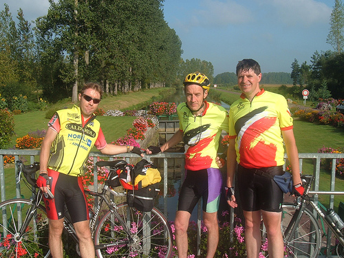
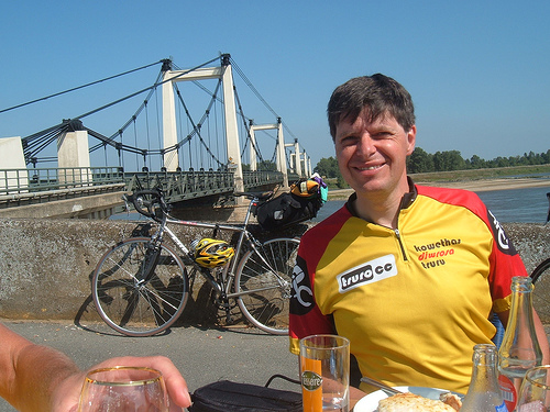
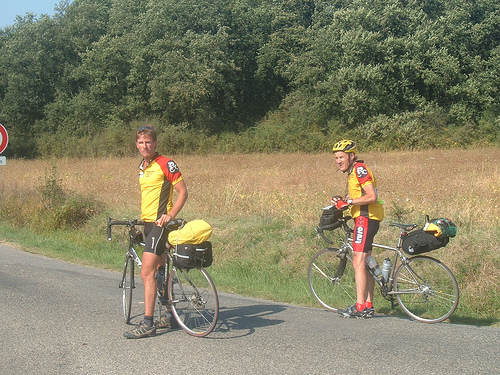
Apparently, sometime last year I (Jeremy Bond) suggested cycling from Roscoff to Santander as a nice thing to do. When I suggested it I was considering a relaxing ride down the west coast of France and along the north coast of Spain.
Three other members of the Truro Cycling Club (Chris Fearnley, Julian Winn and Gareth Smith) also thought the trip was a possibility, but the relaxing route ended up being rerouted to take in the French rolling countryside, the Loire Valley, the Dordogne area and climbing over the Pyrenees, which would mean travelling eleven hundred miles in just over a fortnight.
This is the summary of this trip from the time we arrived at Roscoff in the North West of France to the time we departed Santander in Northern Spain.
Day 1 – Thurs 6th Sept 2007 – Roscoff to Pontivy (92 Miles)
The journey to Santander had begun when we left the ferry (MV Pont L’Abbe) on a cold and misty morning and cycled on the main road south from Roscoff arriving after 6km at St Pol De Leon. We wanted a photo of the group before the massive adventure began so we stopped outside the cathédrale, in the main town square and asked someone to take a photo of us all.
We then cycled to Morlaix to find some breakfast. Morlaix is instantly recognisable by the towering, 19th century viaduct that spans the valley where the town lies. An estuary port, Morlaix prospered from piracy – or privateering, depending on whose side you were on! I was shown the place the Truro Cycling Club always stayed on their annual outings in May and we then found a café and had our first of many french breakfasts.

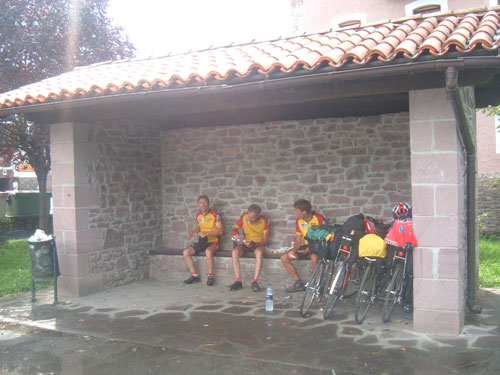
Gareth, Chris and Julian at Carhaix
What amazed me, being the first time I have cycled in France, is how quiet the roads were. The sun came out as we climbed out of Morlaix and continued on the D769 to Carhaix (Carhaix is believed to be the site of the Roman city of Vorgium – one of the principal cities of Roman Brittany). Here we found a nice person who spoke a little English who directed us to the café for lunch.
 Group photo in the cafe at Foret de Quenecan
We continued on the D49 pass Mael Carhaix, and on country rides through Petit Paris (couldn’t see a small Eiffel Tower!) Plounevez-Quintin and Lansicat. We stopped in a café next to some abbey in the enticing Foret De Quenecan. There was a climb through the forest to reach our final destination of the day, Pontivy.
Pontivy has an interesting history associated with it. It’s a medieval town with a fortified 15th century château overlooking the river and it has regimented streets laid out to Napoléon’s plan. It was a military base and he renamed it Napoléonville. It also has an old town, with narrow streets and overhanging wooden houses and apparently a good Monday market.
We headed for the Youth Hostel which opened at 5.30pm…it was 5.15pm, so we sat next to the river beginning to plan tomorrow’s route. The Youth Hostel was on an island in the middle of the river. The rooms were quite basic. The doors had no locks, and we were supposed to supply our own towels and sheets, fortunately they took pity on us and were able to produce some for the night. The receptionist hardly spoke any English, and was amused when we asked for sheets (apparently in French, sheets meant drugs!)
Day 2 – Fri 7th Sept 2007 – Pontivy to Joue-sur-Erdre (104 Miles)
The second day started with a French breakfast at the Youth Hostel, and this is where we had cereal and then used the same bowl for the coffee. Although this was normal in France, it appeared very strange to me.
We left Pontivy and headed to Rohan on the D2, and then we were able to locate the Nantes-Brest canal which is a meandering chain of waterways from Finistère to the Loire, interweaving rivers with stretches of canal built at Napoléon’s instigation to bypass the belligerent English fleets off the coast. Finally completed in 1836, it came into its own at the end of the nineteenth century as a coal, slate and fertilizer route. Road transport had by then already superseded water haulage, but modern tourism has breathed life back into the canal.
 Parking our bikes at Josselin…time for coffee!
The Nantes – Brest canal is a smashing cycle route. The surface was usually good, much better than most British canal towpaths although gravelly in places. It is very picturesque, goes through some equally striking towns and many villages and is of course flat. We pedalled from just outside Rohan to St Congard passing beautiful colourful flower displays on the locks and the riverside towns of Josselin (with the three Rapunzel towers embedded in a vast sheet of stone of the Château) and the thousand year old town of Malestroit.
 Julian, Chris and Jeremy on the canal route
We had a quick stop at Josselin for coffee and to purchase some lunch to eat on the banks of the canal, we cycled another ten miles before stopping to consume our meal. Unfortunately we did not have time to stop at Malestroit as time was against us, the town did look impressive. As we travelled along afterwards over some rough surface of the canal, Chris was having problems with his shoulder, so we left the canal at St Congard and continued on the D764 to Redon which borders Morbihan and Loire-Atlantique.
We had some refreshments at Redon. It was around 3.45pm and we had another forty odd miles to go, so I’m afraid I did not look favourably at this town, as I knew we were only three fifths into the journey for the day, and we were cycling into the wind. We cycled through the villages of Bellevue, Coudray, Vay and had a ride around Nozay trying to get our bearings. We then cycled to Abbaretz before heading into Joue-sur-Erdre at 7pm.
It was a long day, and I was glad to reach our final destinition at the Auberge Du Lion D’Or which is a building dating back to 1850. This was the first of many Logis de France accommodation we were going to use during our travels through France. We booked the night before and were lucky to get two of the five rooms it provides. Unfortunately someone had to share a double bed for the night. Chris and Gareth had that privilege!
Day 3 – Sat 8th Sept 2007 – Joue-sur-Erdre to Saumur (85 Miles)
On the third day we went down to breakfast at 8am, the scheduled time, and found the place empty. A few minutes later, the shutters were opening from the outside and the place was beginning to come to life. There was a baker opposite the accommodation so the hotel had fresh bread on regular supply.
After breakfast, it took a while to get away, as we spent around half an hour ringing around for the accommodation that evening. We eventually find some at Saumur on the Loire River. We decided at this point accommodation must be booked the night before as a lot of cycling time was lost trying to locate somewhere. We left at 9.45pm with Julian and I heading out of the village in the wrong direction, it took us half a mile before we realised and turned back.
 Gareth and Chris at the Ancenis Bridge
When we were back together we headed to Ancenis and this is where I got my first sight of the Loire River. We went over the bridge on the D763 and then followed the local cycle network taking us along the side of the river and missing the main traffic. Unfortunately we came across a number of areas where there were newly laid tarmac, and so eventually we decided to go back onto the road.
 Jeremy at our lunchstop in Montjean
Our final part of the journey took us pass Gennes and onto the D751 to Saumur. You cannot help thinking highly of the town of Saumur as there were cycle lanes everywhere to help us through the heavy traffic of the late afternoon, and it has a graceful Château lording it over the handsome townhouses spread out below on both banks of the river and on the large island mid-stream.
We arrived at the Hotel du Parc which is located outside the town on the other side of the River. The hotel was impressive, the only downfall was the evening restaurant, it closes weekends! So, after the receptionist gave us some confusing directions, we headed into the industrial estate to find a ‘Restanmarch’. This was popular with the locals, and Gareth had his first taste of Cheese and Onion Yogurt! Apparently it was terrible!”
Day 4 – Sun 9th Sept 2007 – Saumur to Le Blanc (84 Miles)
The town was still asleep and the mist was shadowing over the River as we left Saudar at just before nine on a cold morning, once again heading south west following the Loire River. The roads were peaceful as we took the D947 towards Candes-St-Martin. One of the villages we passed next to the Loire was setting up a market on the banks of the river, what a nice place to go shopping!
 Group photo at our coffee stop in l’Ile Bouchard
We left the Loire River behind and began to follow the Vienne River on the D751 heading to Chinon. A few local cyclists were out for their Sunday ride, one from the Saumur Cycling Club cycled with us almost to Chinon. After Chinon we headed to L’Ile Bouchard (Bouchard Island) which is a small town on the River Vienne, where we had our coffee stop. Here, in Dec 1947, unfolded a little-known series of apparitions of Mary, which, despite a slow process of approval, show every indication of being authentic.
From this town we cycled on the D18 passing Ponzay, and the amusing name of Port-de-Piles before entering Descartes on the D5 to look for some lunch. This is where the French Philosopher, Physiologist, and Mathematician René Descartes was born, (at the time the town was known as La Haye). Unfortunately the town appeared to be closing for the day and so we quickly brought some French sticks and ate them with some beer.
We continued our cycling, taking a slight detour to visit the Château de la Guerche which is situated on the River Creuse, and then we reached our next refreshment stop La Roche Posay. This was a nice place to unwind. The people of the town appear to be relaxing in the sun, playing the French game of boules, and talking under the trees in the square
 Julian watching the cycle race at Yzeure
I wish I could do the same but we got on our bicycles again and rode to Yzeures-sur-Creuse where there appear to be a village gathering. We cycled into the village to see what was happening. We first of all thought it was some kind of cheese and wine festival, but it turned out to be a cycle race around the area of the village which began earlier in the afternoon, so we stopped and cheered the cyclists as they cross the finishing line. It must have looked strange for the villagers to see four cyclists in cycling gear not in the race, all wearing their proud new Truro Cycling Club shirts.
We left the village with many bystanders smiling as we came through, and headed on the D750 to Le Blanc. I could not resist taking a photo of Le Blanc, and so lost the other three cyclists as they try and search for our accommodation. Fortunately Chris came back for me, having to fight through a motorbike rally. We stayed at the L’ile D’Avant around 1km outside of the town. When we arrived at around six, the place was close and so we had to wait for the establishment to open and then when we enquire about our bikes, were told to place them out the back in the open, so we sneaked them into our rooms for the night. Gareth cut his thumb on one of the windows, so it was definitely the worst Logis De France accommodation we stayed in so far.
Day 5 – Mon 10th Sept 2007 – Le Blanc to Auphelle (93 Miles)
Our journey continued on another cold morning as we crossed the bridge over the River Creuse in Le Blanc and headed on the D10 and cycled through Belabre and Prissac to reach the little village of St Beniot Du Sault. The village is perched in a curve on a rocky hill and in 1988 this village was named as one of “the most beautiful villages in France”. We tried to stop here for an early coffee, but unfortunately the café was closed.
 Gareth with St Benoit du Sault in the background
The hills were rolling as we cycled on the D15 to Azerables where we bought some French sticks and fillings for our lunch later in the day and then we pedalled through the Limousin town of La Souterraine (literally translates to ‘The Underground’ named in reference to the towns 13th century crypt and its many archaeologist sites) and stopped for lunch next to the Post Office in the square at St Priest la Feuille. Apparently this village is on the Pilgrim Route to Santiago-de-Compostella.
 Lunch stop outside the post office at St Priest la Fuille
After lunch the landscape changed completed as we cycled through St Benevent L’Abbaye (where we stopped for coffee) and continued towards Bourganeuf. A couple of riders wanted to see the reservoir at the end of the Taurion River, so we cycled down into a valley and were disappointed as the dam turned out to be an old warn-out bridge. We continued up the other side of the valley, our first long steep climb since leaving Roscoff. I have a feeling it was around here Gareth dropped and broke his digital camera.
We arrived at Bourganeuf and cycled into the town. Chris went in search of a compass to help with the navigation. The town is a very attractive market town, with interesting buildings and charming little streets to explore. Bourganeuf is renowned for its five storey medieval tower of Zizim (I must have missed that!). After some drinks, and Chris’ unsuccessful search of the compass, we left Bourganeuf on the D51 cycling passed St Martin Chateau and after completing some very steep climbs (which exhausted us) we finally reached our destination at 650 metres above sea level.
 Lake Vassiviere with the island
Auphelle is situated on the shores of Lake Vassiviere. The lake is one of the largest Lakes in France, covering 2470 acres, containing 106 million m³ of fresh water and 45km of lakeside and beaches to explore. In the middle of the lake is Vassivière Island which was created following construction of a hydro-electric dam in 1949 when the lake was created. Eight villages lay beneath the man-made lake as well as the Vassivière flour mill. The lake is a haven for a multitude of water sports and outdoor leisure activities.
 Gareth and Chris planning the next route outside the hotel at Auphelle
After a tiring day in which we glimpsed a few of the many steep hills / mountains to come, and saw temperatures in the region of 26C, it was gratifying to receive a warm welcome from the hosts at the Golf Du Limousin Hotel (the only golf we could see was a mini-golf course by the side of the hotel) as they came out to greet us on our arrival, show us where to place our bikes and then directed us to our rooms. The day ended with a nice sunset over the lake. The sunset, accommodation and scenery were well worth the steep climb!
Day 6 – Tues 11th Sept 2007 – Auphelle to Creysse (90 Miles)
We left the scenic views of our hotel after a group photo on a beautiful morning. It was a cold but sunny morning. The morning went quickly as we cycled through Eymoutiers, situated on the banks of the River Vienne. After a heavy climb out of the village we stopped at Chamberet where we had a cup of coffee. Then came a nice fast run on the D3 into the town of Uzerche.
Dominating the Vezere River, the fortified town of Uzerche is an indispensable stage to discover the noble granite houses dating from 16th, 17th and 18th centuries. We found a pub (Restaurant La Gourmandine) where the locals appeared to be gathered enjoying their food, so we stopped and found ourselves eating a four course meal! We left full and contented after another photo opportunity. Unfortunately the town was built on a rather steep hill in a loop of the river, so we knew we had another climb to continue our journey.
 Group outside the restaurant at Uzerche
We continued on the D920 through Donzenae to our next stop of the day, the capital of the Corrèze area, the city of Brive-la-Gaillardie. Here we stopped in a side street for a lemonade as the temperature increased. Chris continued his unfruitful search for a compass.
Yet another heavy climb greeted us as we left the city on the D38, cycling through Jugeals Nazareth. Another photo opportunity was taken when we cycled through the pretty village of Turenne which sits on the edge of a small hill. A fortress once stood on the hill, all that remains today are the two towers. The village is dated largely from the 13th -16th centuries and has been voted one of the most beautiful villages in France. Unfortunately we did not have the time to stop and experience the lovely views from the top of the hill.
On we cycled through Les Quatre Routes du Lot. We got a little confused at St Denis les Martel as we took the wrong road. It amazed me how Chris knew instantly due to the position of the sun and it wasn’t long before we were back on the right road pedalling along the Dordogne River (who needs a compass!). What a beautiful sight with the high limestone cliffs on our right and the magnificent river on our left. We had to watch the cliffs as they were overhanging the roads and if you were not paying attention you could cycle into them.
Our destination for the day was the delightful village of Creysse. The village is clustered around a little rocky hill crowned by an ancient twin aisled church. We were able to find rooms for the night in the Auberge De L’Ile. We had to take our bikes around a hundred yards along the road to park them for the night in the sister hotel, we had a small problem trying to open the gate to the hotel, but finally solved the way the gate works, you push it!
 Outside the Auberge de L’Ile at Creysse
That night we began to realise something was wrong. Concerns were expressed as to the time we had left to get to Santander. We were doing well with the mileage, but we appeared to have more to go than original thought. Somehow the planned mileage was miscalculated. We may not have as much time in the Pyrenees as planned.
Day 7 – Wed 12th Sept 2007 – Creysse to Caussade (88 Miles)
When we cycled from Creysse on another cold morning, I could tell it was going to be a wonderful day, we were in the heart of the Dordogne. The river looked awe-inspiring and I had heard so much about this unique region of France that provides a whole range of experiences- from breathtaking countryside and awe-inspiring historical locations, to spectacular chateaux and beautiful medieval towns and villages.
 The magnificent town of Rocamadour
The first stop of the day took my breath away. I was amazed to discover it was France’s second most visited tourist attraction after Le Mont St-Michel. Rocamadour is a magical town with golden houses clinging to the side of a cliff over the Alzou canyon. The town is popular for two reasons, firstly because of its beautiful and dramatic setting of the village and secondly the town is an important pilgrimage destination, and has been for 1000 years. Built on the site of a shrine to a Madonna, the shrine became famous for its healing powers, and soon became a stop on the pilgrimage path to Santiago de Campostela. I think for the first time since we landed in France, we actually took a break from our cycling and explored the splendour of the place, cycling into the old town, buying postcards and taking lots of photographs.
We left Rocamadour on the D32, cycling through Couzou and Carlucet to Labastide-Murat where we stopped for lunch (we had Rocamadour cheese!). The next 25 miles to Vers was lovely as it was mainly downhill. During the morning we had at least six steep climbs, so it was nice to take advantage of this long downwards stretch. The only thing that got in the way were the road close sign and the road digger which we were unable to pass on the road. We were able to get around through the back lanes of the local houses.
 Chris cycling past the overhanging cliff in the Lot Valley
After Vers, we took the D662 along the Lot River and I then discovered myself cycling one of the most scenic routes of the fortnight. Forging a spectacular path through the Lot Valley, the upper river Lot is quite unlike any other area in France and the words ‘spectacular’ and ‘breathtaking’ are used in most descriptions of the area. This was an area of ancient castles, medieval villages, narrow gorges and sheer limestone cliffs. We had the cliffs on our left hand sign overhanging the road, and on the right we had a railway line that looked as if it had not been used for decades and the River Lot.
We cycled through St Gery, saw the castle of Bouzies and headed to St Cirq-Lapopie where another spectacular view was awaiting us after our refreshment break. The village is perched on a cliff 100 m (330 ft) above the river and is one of the major beauty spots of the Lot valley with its cobbled lanes, half-timbered houses and gardens. The town is considered to be one of the most beautiful of the ‘most beautiful villages of France’ and I could see why.
Unfortunately we had another 27 miles to cycle to our accommodation, so we didn’t have time to explore the village, instead we climbed out of the Lot Valley heading on the D42 cycling through Concots, Escamps, Vaylats and Puylaroque to Caussade. We were a little worried when trying to find our accommodation as someone said they thought it closed and was converted into apartments. Fortunately for us this was not the case!
Day 8 – Thurs 13th Sept 2007 – Caussade to Montmaurin (103 Miles)
Today we knew we had a lot of mileage to do, we had to get as far south as possible to reach the Pyrenees. It was going to be one of the worst days (long with flat uninteresting views after we had been spoilt with the Dordogne area), but not the most horrible day as that was still to come! The morning was not as cold as previous days when we left the former coaching inn (Larroque) where we stayed for the night. We headed towards Montauben on the N20, we hoped the main traffic would use the motorway which ran parallel, but this was not going to be the case so we left the main road at Realville and cycled on the D78 to Bioule, and headed to Negrepelisse.
Montauban is a prosperous middle-sized provincial city, capital of the largely agricultural region of Tarn-et-Garonne. It lies on the banks of the River Tarn. We were able to find a supermarket to purchase water and fruit. Due to the size of the town and the lack of signposts it was not easy to find our way out so we left the town heading vaguely in the southerly direction. We ended up on the D21 cycling through Corbarleu, Reynies and then joined the D13 to Fronton. A lunch stop was needed and as we entered Grisolles we discovered a hotel which served a three course meal advertised for 10 euros.
We had not booked any accommodation for the night, and so the hotel staff kindly rang around the Logis De France Hotels around Lannemezan. Luckily the hotels were fully booked! as I did not fancy cycling another 90 miles on top of the 40 miles we had already cycled, especially when one of the staff at the hotel who was a cyclist told us it was too far even for the fittest cyclist to do by the end of the day. So we still had no where to sleep that night. We also decided while eating our meal that we would have to miss the first climb in the Pyrenees (the Aspin) due to lack of time. Nothing was going right for us.
On our departure from Grisolles we experienced a small white van overtaking us when a large lorry was heading in the opposite direction. The lorry would have pushed the van into us if they collided, and that would have been the end of the trip and us! Fortunately the van pulled in just in time.
 Tourism Office at Isle Jordain
We continued our pedalling through Grenade (we find no small hand held explosive devices) and joined the backroads to Isle Jourdain where we had a refreshment stop at the local Tourist Information Centre which was situated next to a small lake. The young lady who spoke English was able to book a French Gite for us around 40 miles away in a pretty village of Montmaurin.
 Getting our bearings somewhere outside Fronton
On our bikes again, and we went though Samatan, Isle en Doden and St Laurent .There was a heavy climb into Montmaurin and we arrived at last at our accommodation at approx 7.45pm. It had been a long day and we were all exhausted. Our hosts welcomed us into their home, regrettably they could not speak a word of English. There were two double beds and a single, so Julian and I had the privilege of sharing a double bed. Fortunately it was the one and only time during the fortnight I had to do this. After eating out every night, the food was plain and the wine cheap, but it did not matter, as we reached the stage we just needed somewhere to recharge our batteries.
Day 9 – Fri 14th Sept 07 – Montmaurin to Bagneres de Bigorre (39 Miles)
First of all, let me explain the plans for the next three days. We calculated we had enough time to do two main climbs in the Pyrenees (Tourmalet on Saturday and the Aubisque on Sunday) so our accommodation needed to be at the foot of each of these mountains. I had decided not to attempt the first climb, but to just take my time and cycle slowly around the mountain, maybe visiting the town of Lourdes. Chris was unsure what he wanted to do, he was still having problems with his shoulder. When Chris was last in the Pyrenees he came by car and he’d wished (as he saw the various cyclist tacking the mountains) that he had his bike with him. We joked stating that probably if he attempted the mountains on his bike…he’d wished he had his car!
So after our late breakfast of dry bread and untempting homemade jam we booked the next two nights accommodation with ease. As we left Montmaurin on the D633 heading towards St Plancard we noticed Julian was finding cycling difficult, he had a sore archilles tendon. The best way to treat this is to rest it, but when you are in a middle of a cycling holiday and you had yet to tackle the mountains, it was not good news. Luckily Julian is a fast rider, so slowing him down did not effect the speed of the rest of us!
 The local farmer on his bike, gathering his sheep
As we cycled towards Villeneuve-Lecussan we ran into an old farmer on his old bike leading his flock of sheep along the country road with the assistance of his two faithful farm dogs. We slowly followed the parade taking a couple of photographs. The sheep eventually allowed us to pass and we continued into the town of Lannemezan where we searched for some cycle helmets for Julian and Gareth (helmets are compulsory in Spain). The choice was limited so they decided to wait a bit longer before purchasing.
We then headed to Capvern-les-Bains for our lunch stop. Most towns in this area had been built up due to the popularity of health spas in the victorian age. Capvern-les-Bains is one of the oldest thermal resorts of France, dating back to the Roman era. After our meal it was decided as we had a lot of spare time we should head to Bagneres de Bigorre (our final destination for the day) on the back roads. As we cycled through Bonnemazon and Argeles Bagneres we discovered our detour was quite hilly with some really steep climbs, so steep that a couple of us had to walk…good practice for the mountain stages!
We reached Bagneres de Bigorre at approx. 4pm and searched for our accommodation. The town is another Pyrenean spa town, once famous for its hot springs. You could see the town is trying to rebuild its faded image. We had a nice relaxing evening, at last finding a compass for Chris, and having a nice meal in one of the town’s restaurants where there was a whistling waiter who refuses to give his customers milk with their evening coffee!
 Leaving our accommodation in a French Gite
There was a little panic when we arrived back at the hotel as one of the keys were handed in at reception before the meal, and on our return the reception area was locked for the night. Fortunately we were able to locate a member of staff in his home who was able to give us the key to the locked room.
Day 10 – Sat 15th Sept 2007 – Bagneres de Bigorre to Argeles Gazost (30 Miles)
Chris, Gareth and Julian had a hard day ahead of them climbing the Col du Tourmalet which is 2114 metres above sea level. Perhaps the most famous climb in the Pyrenees, the Col du Tourmalet or ‘terrible mountain’ is essential to any cycling tour in the south of France as you don’t come any fiercer than this. The Col du Tourmalet is one of the big five continental climbs. To help Chris and Julian with this massive task, I took some of their luggage with me.
 Chris has conquered the Tourmalet!
They had a great day tackling the mountain, in summary, on the way up our three cyclists were overtaking other cyclists who had no luggage, infact people were impressed by how they tackled the mountain while being weighted down with their luggage. Also on the way up they were passed by a parade of porsches and when they reached the top there appeared to be some kind of mountain bike gathering. They had a coffee / beer stop and took lots of photos. On the way down they had a strong head wind and they were slowed down by a camper van which was holding up the traffic.
As for me – who was left behind with the extra luggage – I knew I would be struggling to reach the summit because my bike was a lot heavier than the other three bicycles. So I thought it would be better if I missed the climb as I had one ahead of me the next day. To be honest I am glad I did as I had the whole day to myself and saw the wonderful sights of Lourdes.
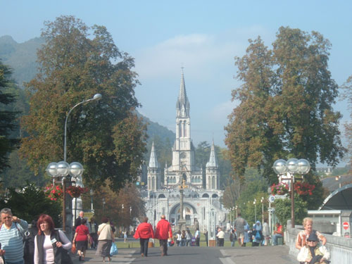 The Basilica of the Rosary in Lourdes
Lourdes was originally a small unremarkable market town lying in the foothills of the Pyrenees. At that time the most prominent feature was the fortified castle which rises up from the centre of the town on a rocky escarpment. Following the claims that there were apparitions of Our Lady of Lourdes to Bernadette Soubirous in 1858, Lourdes has developed into a major place of Christian pilgrimage (Mainly Catholic). More than five million visitors from all over the world visit Lourdes every year. The church known as the Basilica of the Rosary was a magnificant sight (reminded be of Cinderella’s castle in Disney World). I even had the chance to see the most mystic place of all in Lourdes, the Grotto where Bernadette felt the tremulous breeze announcing the apparition of the Virgin, and here, rapt in prayer she had her holy visions. I could see why Lourdes has the second greatest number of hotels in France after Paris!
I cycled out of Lourdes and found just outside the town an amazing cycletrack – based on the old Lourdes to Pierrefitte-Nestalas train line. Today it is a beautifully smooth and delightfully car-free cycletrack – to be shared with joggers, inline skaters and a lot of cyclists. The path takes you from Lourdes right up to the foothills of the Pyrenees, with stunning views of Pyrenees.
It was on this cycletrack that I met the climbers on their return from the Col du Tourmalet, so we were able to cycle into the town of Argelès-Gazost where we were going to stay the night. The town stands at the crossroad of the Lavedan valley and is surrounded by various mountains. Although we had a nice relaxing evening, I have to admit I was a little apprehensive about the next mountain climb, mainly because I was going to be involved with it!
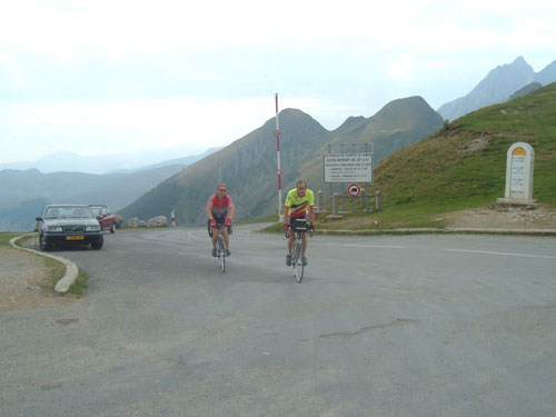
Day 11 – Sun 16th Sept 2007 – Argeles Gazost to Larcevean (87 Miles)
Tonight we had hoped to cycle to Larrau which is a village high up in the Pays Basque on the Spanish border, however the Logis De France accommodation was fully booked. We were able to find accommodation at Lancevean, but this would involve us having to do another 60 miles after the morning’s mountain climb, so I was warned this was going to be a hard day.
 The road to the Aubisque
As I knew I was going to be the slowest rider of the day, I cycled out of Argelès-Gazost a good 30 minutes before the others. I was on a mission to reach the top at around the same time as everyone else. There were going to be two mountain climbs this morning, the first was to the Col du Soulor which is a 20 km long. I was expecting the climb to begin immediately but this climb only got tough after the village of Arrens with zones of 10% and more. Every kilometre there was a sign telling you the distance to the summit and the hill ratio for the next kilometre so that you can prepare yourself. By the time I reached the summit I was1474 meters above sea level. I stopped for a photo opportunity and a drink waiting for the other three to catch me up, and when they did not appear, I decided to go ahead and tackle the next summit, the Col d’Aubisque.
The road from the Col de Soulor is a very spectacular, attractive road running along cliffs in the Cirque du Litor, where the traffic is controlled through two short, narrow tunnels. One of the tunnels was cold, dark, damp and unlit, so I quickly cycled through it, as I was afraid a car may hit me from behind. It was a spectacular experience cycling half way up and along a 2000 meter sheer slope that rises up out of a beautiful valley looking 1000 meters up to the peak and then down 1000 meters to the valley floor. From the cirque du Litor, the climb is 7.5 km. Gareth overtook me at this stage. By the time I reached the Aubisque I was 1709 metres above sea level.
 Gareth next to the King of the Mountains Bike
The view at the top was absolutely stunning – I think you have to ride these mountains to appreciate the difficulty of the climb and the spectacular nature of the views at the top. The names Col du Soulour and Col d’Aubisque should sound familiar to cycling fans and in one morning I had conquered them both! On the summit were three large bicycles (yellow, green and polka-dot) which represented the classification jerseys of the famous french cycle race. Infact I was standing in the place where only seven weeks earlier stage 16 of the 2007 Tour de France had finished.
 Julian and Chris reach the Aubisque
Chris and Julian reached the Aubisque around half a hour after Gareth and I as they stopped for a rest at the Col du Solour. Julian was still taking it easy with his injured archilles tendon. By the time they reached the summit, Gareth was just about to leave to find some proper food in the next town, and so the rest of us relaxed on the Aubisque and purchased some sandwiches and a drink. I was in no hurry to leave after a three hour thirty kilometre climb.
 View over the Ossau Valley
I left Chris and Julian at the summit as I attempted my first mountain decent. I was determined not to go too fast so my hands were consequently on the brake levers. You don’t appreciate the strain you are placing on your hands when you are consistently braking for ten miles. The journey down on the west side of the summit appeared steeper than the east side as I cycled through Eaux Bonnes passing various cyclists on their way up. Both Julian and Chris overtook me on the decent, so I was the last to arrive at the valley floor in the town of Laruns. As I entered the town from above, the view over the Ossau valley was amazing as steep wooded hills rose up around the town. In the centre of the town as a focus point is a fountain which apparently has drinkable water (as the local restaurant owner where Gareth dined kept informing us).
We knew we had approx 50 more miles to cycle, so I was ready for a hilly ride. However, fortunately the cycle ride was mostly flat. Chris had planned to cycle over the Col du Porteigt, but when we cycled through Bielle and saw the massive hill on our left we decided, much to my relief, to cycle around it heading to Arudy. The journey from Arudy to Lurbe Saint Christau was a gentler charming alternative, primarily cycling through a forest on the D916.
We then headed towards Arette where we saw a lady cyclist in front. I believe she had one of those bikes with a basket on her front handlebar. Anyway, she was an athletic cyclist as most of us were unable to catch her up. I think Gareth succeeded! After a quick drink stop in the village we continued on the D918 through Montory and Tardets Sorholus. We took a shortcut through
Menditte and Mendy and rejoined the D918 for the final stage of the journey.
 Exhausted at the top of the Col d’Osquich
We were all getting tired at this stage, but there was still one more sting in the tail, the Col d’Osquich. Although this was only 507 metres above sea level, it was a hard climb as there were no trees to block the sun and no wind to cool us down. At the top Gareth found a small restaurant, so we had a welcomed beer stop with panoramic views of the valley below.
 The view from the top of the Col d’Osquich
We eventually reached our accommodation at around 7.30pm at Larceveau. This was going to be our last night in France, as tomorrow we were crossing the border to Spain. Our main aim now was to reach Santander.
Day 12 – Mon 17th Sept 2007 – Larcevean to Tolosa (72 Miles)
We left the hotel in good time heading towards the Spanish border along the D933 which was the main road to St Jean. St Jean Pied de Port is the ancient capital of the Basse Navarre lying on the river Nive. Unfortunately we did not have the time to explore its ancient town houses, the narrow streets or the fine citadel. Instead we visited a bike shop to allow Julian and Gareth to purchase their helmets for the Spanish part of the journey.
 Julian and Chris on the Spanish Border
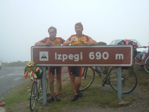
We then cycled to Saint Etienne de Baïgorry on the D15 for our coffee stop, the last stop in France. St Etienne is a typical village in the Basse Navarre that has retained its authentic charm, nestled in one of the greenest valleys and overlooked by the Pyrenees foothills. The village also lies below the nearby Col d’Ispéguy which was going to be our next challenge. We joined the D949 and began our hour climb to the Spanish border at the height of 672 metres above sea level. Although it was a stunning pass, the cycling was hard and appeared to be never-ending as we cycled into the damp clouds. At the summit there were no border controls, no guards checking passports, not even a sign, just an old rushy post coming out of the ground which I assumed was where the border barrier used to lie. After a photo opportunity we all cycled down into the village of Erratzu. My first impression of Spain was how poor the conditions of the road were compared with the French roads.
 Jeremy on the Spanish Border
After leaving Erratzu with its narrow streets (I wouldn’t drive anything big around this village) we headed through Elizondo to Oronoz Mugain. On route I lost a brake block, luckily Julian had spares and so this was easily solved. As we were entering Oronoz Mugain we could see the black clouds building up so we knew we were in for a downpour. Luckily we were able to buy some food in the local shop and took refuge from the storm in a bus shelter.
 Taking shelter from the storm at Oronoz Mugain
After the storm we headed on the NA170 and faced another heavy climb, this time on the Puerto de Usateguieta which is 695 metres above sea level. Although the climb was long and hard, it was a little scenic as we cycled in between the massive number of trees located on the side of the hill. We were stopped once by some Council workers blocking the road while doing some road maintenance.
When we arrived at Leitza, we headed on the GI 2130 to our final destination of Tolosa. Although the road began hilly it ended with a brilliant descent down to the city. My first impression of Tolosa was not pleasant as there was an ugly concrete bridge going over the city where the roaring motorway was positioned and the waters in the River Oria were brown and polluted.
 Chris having trouble with his shoulder on the Puerto de Usateguieta
Fortunately Chris was able to locate the tourism information centre and as it rained for the second time of the day, we went exploring in search of a bed for the night. We found the Pension Karmendxu, where we could park our bikes in the lobby. We had to share the bathrooms with other residents, but we didn’t mind as long as we had a bed for the night. We finished the day with a Walk around the city which follows the Spanish colonial model of high buildings and narrow streets, built to block out the midday sun.
Day 13 – Tues 18th Sept 2007 – Tolosa to Bilbao (65 Miles)
We awoke a little later than normal and headed to a café just down the street where we had a nice breakfast. The main conversation was how Spanish cyclists appear to ignore the law concerning wearing cycle helmets, especially as Gareth and Julian had just invested in two! At this stage of the day we were not aware of the nightmare the day was going to hold for us. This was going to be the worst day of the fortnight. We should have known, being Day 13!
The day began badly as we left Tolosa on the GI2634. It was a steep climb out of the valley and although from the map the road appeared a quiet road, we ended up with heavy good vehicles overtaking us at high speed and not allowing much room for safe passing. So it was decided to turn off the road at Bidania and head on the GI3740. This took us higher into the mountains through Goiatz, Urraki height and Elosiaga district to Azpeitia. This route took us along a picturesque road, and showed us breathtaking views over the Errezil Valley and Ernio Mountain, but we did not appreciate this to its full glory as we were getting tired from the continuous climb.
We arrived at Azpeitia which sits at the foot of Mount Erlo. We were all wet and feeling depressed, so we decided to take shelter in a smokey pub situated next to the River Urola and purchased some hot coffee and snacks (We must have been tired as Gareth and I would normally not set foot in a smokey room). The rain ceased so we decided to set of again towards Bergara.
We were in the Basque Country which is known as Little valleys among mountains, well we appeared to be discovering these mountains for as we left Azpeitia and took the GI3750 we were climbling once again into the Elosu mountain. This time as we climbed higher it began to rain, not just a gentle grizzle but it bucketed down, and there was no-where to take cover, even the trees were no cover for the downpour. It was during this rainstorm, that we had our first puncture of the trip, unfortunately this happened to Julian who had to change the inner tube in a barn next to the road.
When we all reached Bergara we were wet through, so we all invaded a small pub by the side of the road and began to get dry. I had to change into dry clothes or else I knew I would get hypothermia. Julian thought he had another punchure, so not only was the inner tube replaced again, but Julian also replaced the tyre. The rain had stopped after we each had two cups of hot coffee so we continued our trek towards Durango travelling on the G2632, and you guessed it, another long steep climb before reaching Elgeta. Then we cycled through Elorrio and headed towards Durango.
When we left the industrial town of Durango we knew we were going to be faced with the worst part of the trip…the N634. The N634 has a motorway running parallel to it, but unfortunately to use the motorway you had to pay a toll, so all of the traffic chooses to use the N634. There is no cycle path and no side road, so the N634 was our only option if we wanted to cycle west, which meant we had to share it with fast cars and heavy lorries. There was a white line along the side of the road, but with vehicles going past at high speed, we did not feel that safe.
 Julian, Chris and Gareth in Bilbao
We were relieved when we eventually reached our stop for the night, the city of Bilbao. This is Spain’s biggest port and sixth largest city. Bilbao has the spectacular Guggenheim Museum which opened in 1997 signalling the dawn of a new era for this heavily industrialised city which previously held little interest for the international traveller. I have to admit both Chris and Julian were keen to visit it the next day, I hadn’t even heard of the museum before! When we cycled past the museum you couldn’t help but notice Jeff Koons ‘Puppy’ which has become a noted icon in the city. This is a 13 metre structure, constructed to hold 25 tons of soil, covered in plants and flowers. I have to agree, it does look a bit like a Kitten!
 Jeff Koons’ Puppy
Bilbao is an impressive city with the new state-of-the-art metro system and a host of projects designed to regenerate run down areas of the city. I could see how the city was trying to create a new Bilbao – a vibrant, dynamic centre of culture and commerce where ancient and modern architectural styles mix well together. I was well impressed with the place. We managed to find the Tourism Information Centre and with their list of hotels managed to book into the Pension Mendee which is situated in the old part of the city where, like Tolosa, you had the narrow streets and high buildings.
Day 14 – Wed 19th Sept 2007 – Bilbao to Somo (72 Miles)
The aim of today was to reach Santander Bay to enable us to catch the ferry back to Plymouth on the following day. We have tackle all of the large mountains and so today should be a nice restful ride along the coast of Northern Spain. Gareth and I were all prepared to begin the ride by ourselves as Chris and Julian wanted to visit the Guggenheim Museum, this meant they would be spending the afternoon racing towards Santander, however the museum was not due to open until ten, and Julian would need all day to look at the museum’s motobike extravaganza. So Chris and Julian reluctantly agreed to come with us and explore the coast.
We left the old town of Bilbao early at 8.15am and cycled along the bank of the Nervion River, we wanted to follow the river all the way to the ocean, but stopped at a great iron gate indicating the end of the cycle route, which put an end to that plan. Instead we joined the now famous N634 a little way and turned off to cycle through the marine town of Santurtzi heading to the mouth of the river. We eventually reached the fishing town of Zierbena which lies in the Somorrostro Valley. Unfortunately there was not much to see as we had a snack and coffee in the local bar. It was a little disappointing detour
 Arrived at Castro Urdiales
The Somorrostro Valley must once had been a beautiful valley, but now as we cycled towards Muskiz on a cycle lane, there is a massive oil refinery which is not only ugly to look at, but smelly as well. We once again joined the N634, as the motorway to Santander was not charging tolls at this stage, the road was very peaceful. We eventually cycled into the seaport of Castro Urdiales. The town has all the charm of a small seafaring and fishing village with a rich tradition and tourist atmosphere. The buildings of the church of Santa María and the castle-lighthouse, visible from all parts of town, are the most representative sights in Castro Urdiales. Here we stopped for lunch and tried all kinds of sea food including sardines, squid and mussels.
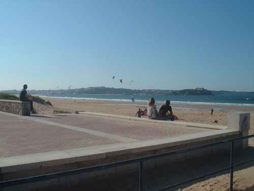
We continued along the N634 cycling through Laredo (which has one of the biggest and most beautiful beaches in the region) and Colindres (which is the second fishing port of the region) and headed to Santona which is situated by the bay of the same name. From this village we headed to the Playa de Berria (Berria beach) which is very popular with the surfers and stopped for a nice cool beer.
 A photo stop coming into Laredo
Our cycling was nearly over as we headed the 15 miles to our next overnight stay. Outside the town of Somo is a cycle lane running parallel with the road. However, what was built as something to help cyclists ended up to be a very dangerous for cyclists. For some reason the people who constructed the cycle lane decided in their wisdom to place bollards at regular intervals throughout the length of the lane and two or three times I almost crashed into them.
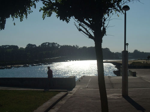
 Overlooking Santander Bay at Somo
We eventually reached Somo which is a small town situated on a narrow sand peninsula that closes the Bay of Santander, across from the city. After fourteen days of cycling we could at last see our final destination across the bay. We were almost home.
 Sunset at Somo
We needed to get to the Brittany Ferries office as soon as possible to sort out how we could get Julian back to Plymouth. The 20 minute boat service to Santander was nice and smooth and I was surprised how shallow the water was. It amazed me how easy it was to fall overboard as there were no barriers on the boat shuttle, it appears the European laws on health and safety are yet to reach northern Spain! As we came into the capital of the region we could see the Brittany Ferries ship (MV Pont-Aven) docked.
 Placing the bikes onto the boat shuttle
On arrival to Santander we pushed our bikes into the port and reported to the Brittany Ferries office. They were amazed Julian did not notice his passport was missing in the last fortnight, but after making a couple of calls to Plymouth they agreed to allow him on the boat. Once we were in the port, we were not allowed to take our bikes out again to explore the city, so Gareth and Chris went by foot to get a drink. Chris almost lost his bag when he wandered into the city as he left it in the café. Fortunately a kind person came up to them with the bag, at first Chris thought the gentleman was being a little bit sinister until he saw his bag!
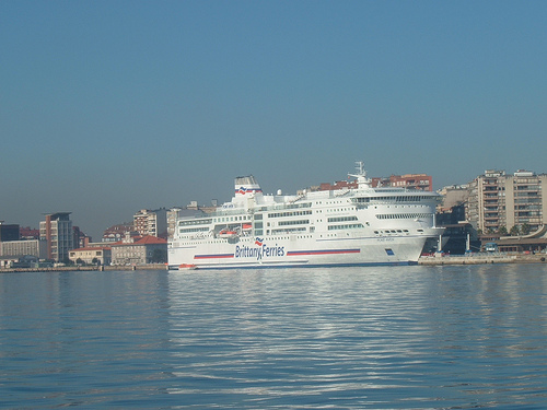 Brittany Ferries ship MV Pont Aven in dock
When eventually we were allowed to board the ship we discovered we had no boarding passes as it was overlooked by all of us due to the chaos over Julian’s passport, so we had to rush back to the Brittany Ferries office and retrieve them before continuing on our journey home. We were eventually allowed on the ferry for our journey home, we had done it, cycled from Roscoff to Santander and we were all looking forward to getting back to Cornwall!
Conclusion.
The fortnight was quite challenging and the trip had it’s ups and downs. We cycled approximately eleven hundred miles spending about 86 hours in the saddle. I am sure we were all delighted when we reached the destination of Santander without any worrying incidents. We all agreed that Spain was our least favourite part of the journey and we were in no hurry to come back to this area with our bicycles.
For me the highlights of the trip were Rocamadour and the Lot Valley on the seventh day, the beautiful city of Lourdes on the tenth day and the climb to the Col d’Aubisque on the eleventh day. The lowest point of the fortnight had to be day thirteen with the continuous climbs on a wet day followed by the dangerous ride along a busy route to get into the Spanish city of Bilbao.
Although I appreciated the route we eventually cycled, if I was going to recommend cycling from Roscoff to Santander to anyone else, I would suggest they cycle the shortest way, down along the French coast. Not many mountains that way…and less mileage!…but I am pleased I was persuaded to cycle the longer route.
For me, I would like to thank Julian and Gareth for their company during the fortnight, and special thanks has to go to Chris who was the key member of the team. Infact, all of us would like to express our thanks for his organisational skills in completing the initial planning. Chris spent a considerable time planning the three possible routes, and once the route was chosen, getting all the maps together to guide us through the roads of France and Northern Spain. Chris also arranged the ferries, and the extra bonus was Chris could speak a little French which enabled us to book our rooms for the following day. Thanks Chris!
